
Executive Summary
On 14 May 2025, Bharat Pulse News and Statscope Research India published an analysis of damage reported at Nur Khan Air Base near Rawalpindi. The article used satellite-image interpretation to discuss a limited impact area and proposed a strategic explanation for the target choice. It also suggested a link to command infrastructure. The archive preserves the original analytical argument while distinguishing observed damage from the unverified attribution of particular structures or functions.
Research Objectives & Scope
The study asked what imagery could reveal about the apparent impact footprint, which structures might have been affected and how limited damage could be interpreted in the wider military setting. The assessment was not a population survey; it was an open-source strategic investigation.
Key Findings
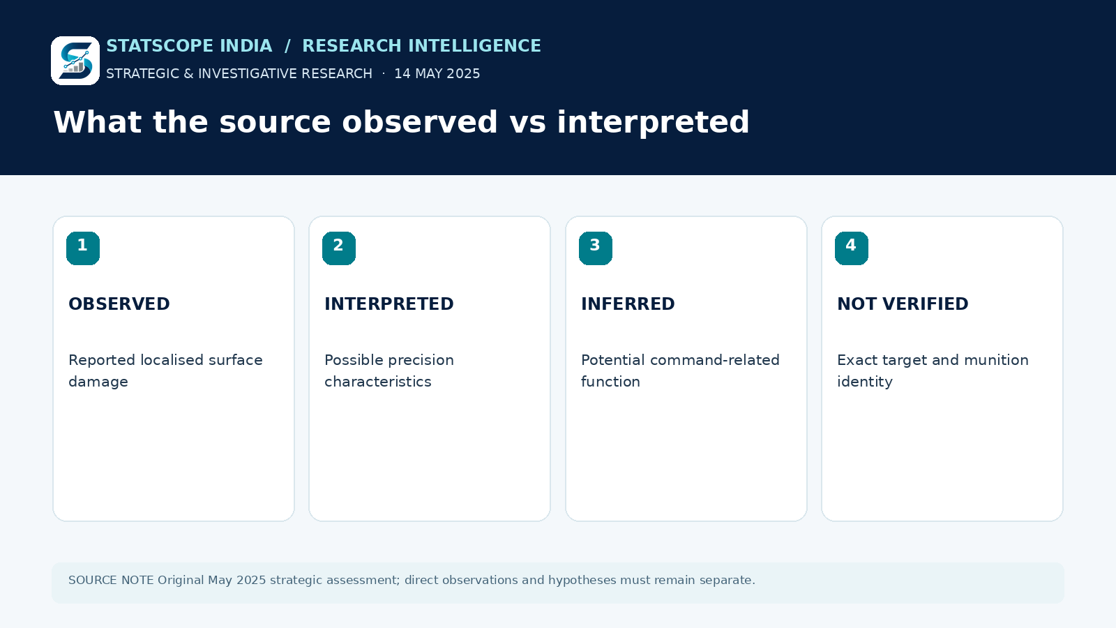
The original publication described a concentrated crater-like area, debris and damage to selected buildings, while reporting comparatively limited effects on nearby base infrastructure. It interpreted that pattern as deliberate precision. It also proposed that a command-related node might have been involved. The latter attribution is a hypothesis in the article rather than a verified designation based on accessible facility records.
Research Approach
The article relied on before-and-after satellite imagery, interpretation of damage signatures and comparisons with known types of military infrastructure. The accessible publication does not provide complete georeferenced imagery layers, a published independent imagery audit or contemporaneous facility documentation that would settle the proposed target identification.
Analysis & Implications
Separating observable damage from tactical intent is essential. A localised impact area does not, by itself, establish a specific munition, the decision process behind targeting or the role of a building. Strategic interpretation can be useful when its assumptions are made explicit; it becomes misleading when presented as direct observation.
Outcome & Retrospective
This record documents the conclusion advanced by the research partnership in May 2025. It does not certify that every target-related or strategic claim was subsequently confirmed.
Limitations & Interpretation
The infographic shows an evidentiary hierarchy rather than a satellite-image reconstruction. No claim of a specific destroyed command installation is presented as independently proven.